Importing GBIF data into QGIS
QGIS is a free and open source desktop GIS application, available on Windows, Mac and Linux.
GBIF occurrence data can be imported in at least three ways.
-
Import a GBIF download when your GBIF query includes 20,000 or more occurrences
-
Use the community-made plugin for some queries returning up to around 20,000 occurrences
-
Use the Maps API for visualization only, without any analysis of the data
GBIF basemaps can also be imported.
Importing a GBIF download
-
Download the desired occurrences in either Simple or Darwin Core Archive format.
-
Unzip the downloaded file.
-
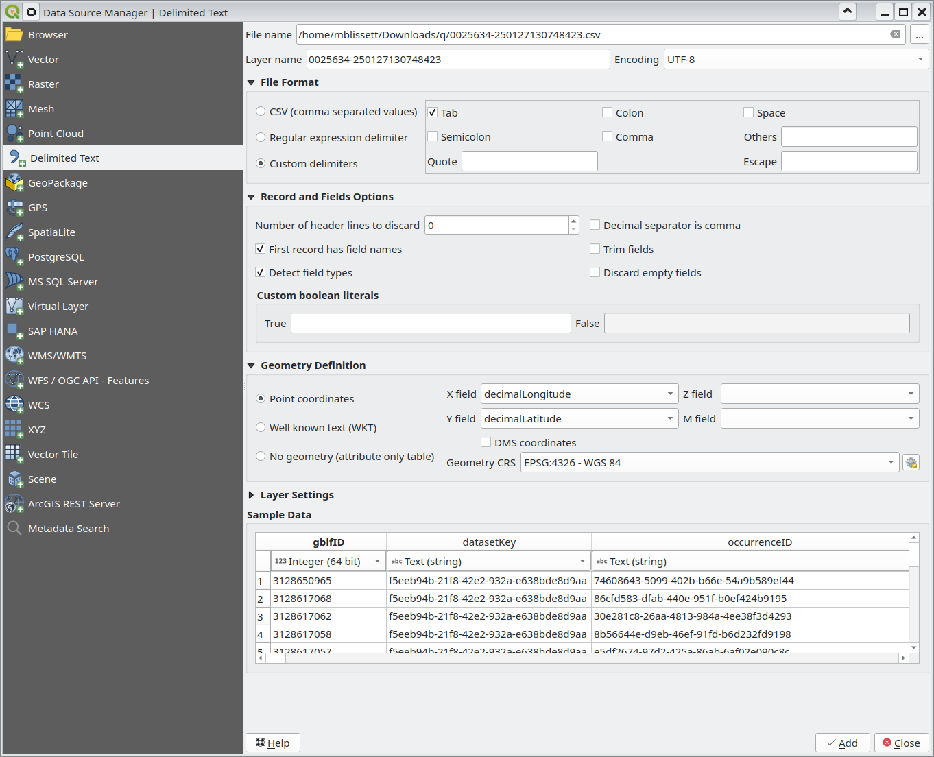
Choose Layer → Add Layer → Add Delimited Text Layer…
-
For Simple format, choose the unzipped file ending ".csv"
-
For Darwin Core Archive format, choose the unzipped file called "occurrence.txt"
-
Ensure the Encoding is set to UTF-8
-
Set the File Format to Tab delimiters without quotes or escapes
-
The Geometry Definition with the fields decimalLongitude and decimalLatitude should be filled in automatically
-
-
Click Add, then Close
Using the plugin
The GBIF Occurrences plugin is developed and maintained by Nicolas Noé.
-
Click Plugins → Manage and Install Plugins….
-
Search for "GBIF" and select and install the GBIF Occurrences plugin.
-
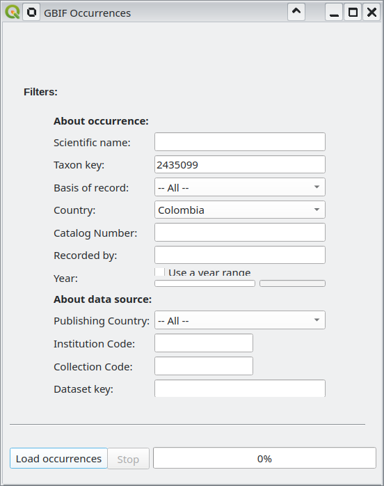
Click Vector → GBIF Occurrences → Load GBIF Occurrences.
-
Fill in either a scientific name or a taxon key, and any other search filters. (The easiest way to find a taxon key is to search the GBIF backbone taxonomy on the website and copy the key (number) from the URL.)
-
-
Click Load occurrences
The plugin is limited to retrieving 100,000 occurrence records, but numbers above around 20-30,000 will be slow to load.
Visualizations with the Maps API
The Maps API is designed for visualization, it is used for all the maps on GBIF.org and can be embedded on other websites. It is of limited use for analysis, but can be useful for preparing customized maps.
When using this API, QGIS only supports maps in Web Mercator 3857 projection.
-
Refer to the Maps API documentation to find a suitable URL template, for example
https://api.gbif.org/v2/map/occurrence/density/{z}/{x}/{y}@1x.png?srs=EPSG:3857&taxonKey=6&bin=hex&hexPerTile=57&style=classic.polyfor all plants. -
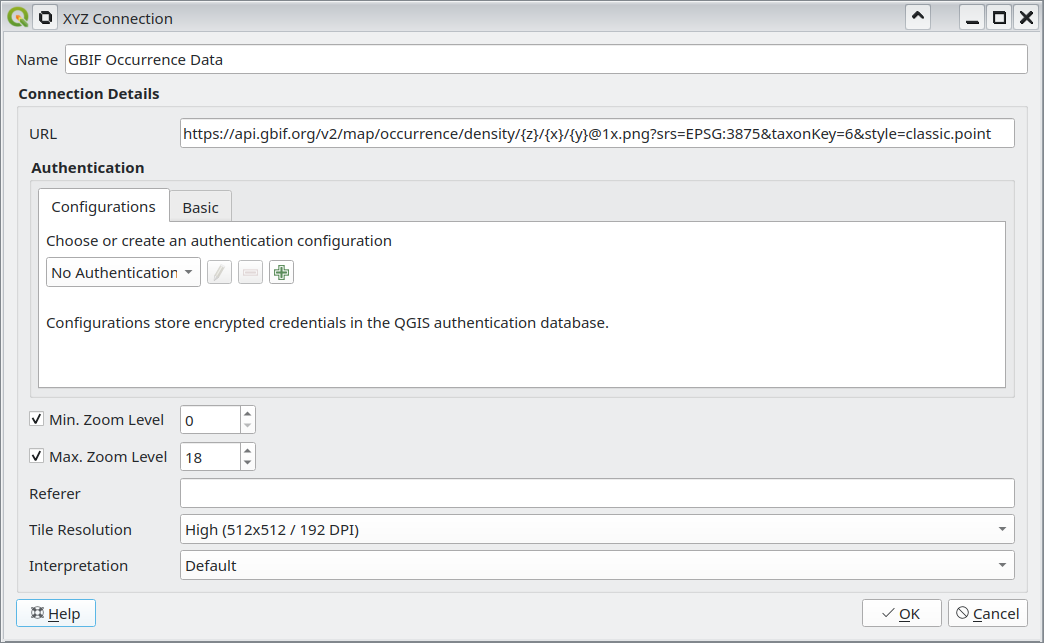
Choose Layer → Add Layer → Add XYZ Layer…
-
Create a New connection, choose a name, and paste in the URL template.
-
Set the Tile Resolution to High (512x512 / 192 DPI)
-
Click OK
-
-
Click Add
Using the GBIF basemaps
The GBIF Basemaps can also be added as a layer.
-
Choose Layer → Add Layer → Add WMS/WMTS Layer…
-
Choose New
-
Type a name, and use
https://gbif.link/wmts-baseas the URL -
Click OK
-
-
Click Connect
-
Choose a layer matching the CRS you are using and the style you wish, then click Add.