Importing GBIF data into ArcGIS
ArcGIS Desktop is a desktop GIS application available on Windows.
GBIF occurrence data can be imported in at least three ways.
-
Import a GBIF download when your GBIF query includes 20,000 or more occurrences
-
Use the official ESRI plugin for some queries returning up to around 20,000 occurrences
-
Use the Maps API for visualization only, without any analysis of the data
GBIF basemaps can also be imported.
Importing a GBIF download
-
Download the desired occurrences in either Simple or Darwin Core Archive format.
-
Unzip the downloaded file.
-
Choose Map → XY Table To Point
-
For Simple format, choose as Input Table the unzipped file ending ".csv"
-
For Darwin Core Archive format, choose the unzipped file called "occurrence.txt"
-
The X Field and Y Field should be filled in automatically with decimalLongitude and decimalLatitude
-
-
Click Run

Using the plugin
The Download Species Occurrence Points (GBIF) plugin is developed and maintained by ESRI.
-
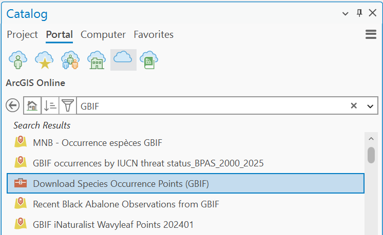
From the Catalog, choose Portal → ArcGIS Online.
-
Search for "GBIF" and select the Download Species Occurrence Points (GBIF) toolbox.
-
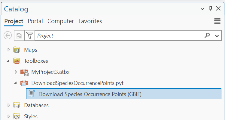
Right click it and Add to Project
-
You may need to confirm you wish the toolbox code to run
-
-
Return to the Catalog and choose Project, then the GBIF toolbox.
-
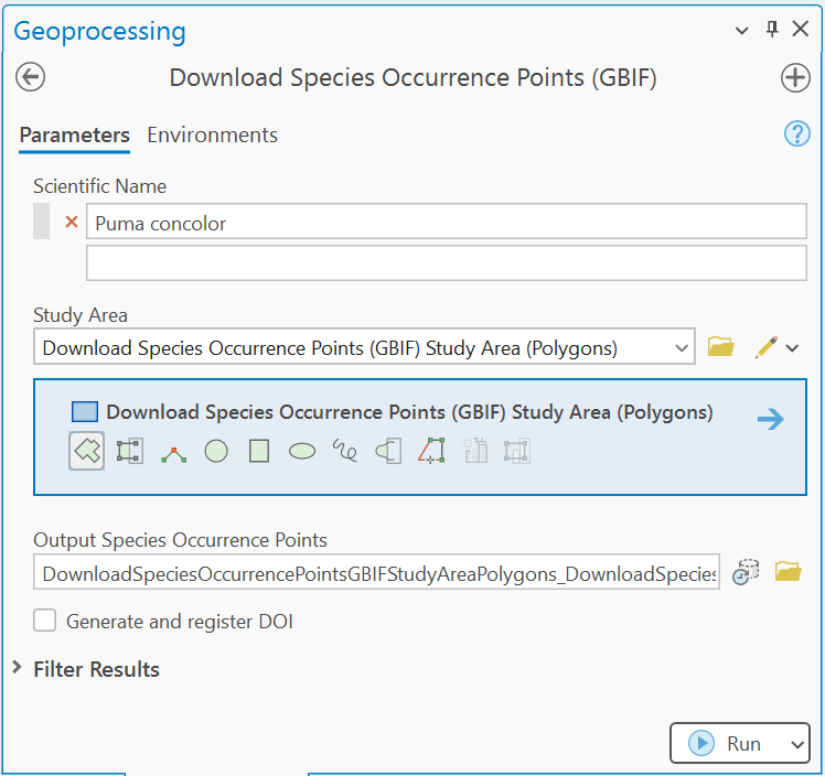
Run the toolbox.
-
Provide a scientific name, and select or draw a study area
-
Optionally, choose to Generate and register DOI
-
Click Run
-
The plugin is limited to retrieving 100,000 occurrence records, but numbers above around 50,000 will be slow to load.
Visualizations with the Maps API
The Maps API is designed for visualization, it is used for all the maps on GBIF.org and can be embedded on other websites. It is of limited use for analysis, but can be useful for preparing customized maps.
-
Refer to the Maps API documentation to find a suitable URL template, for example
https://api.gbif.org/v2/map/occurrence/density/{z}/{x}/{y}@1x.png?srs=EPSG:3857&taxonKey=6&bin=hex&hexPerTile=57&style=classic.polyfor all plants. -
Choose Map → Add Data From Path
-
Paste in the URL template.
-
-
Click Add
Using the GBIF basemaps
The GBIF Basemaps can also be added as a layer.
-
Choose Insert → Server → New WMTS Server
-
Und use
https://gbif.link/wmts-baseas the URL -
Click OK
-
-
From the Catalog (Project), Under Servers add the base layer
-
The style can be changed be right-clicking the layer and changing the property under WMTS.