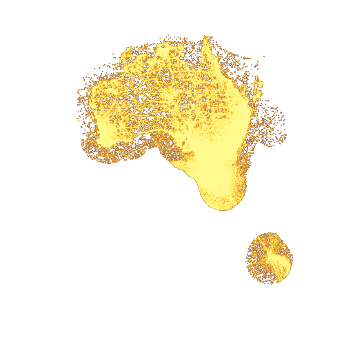
{"openapi":"3.1.0","info":{"title":"Maps API","description":"The mapping API provides [tiled web maps](https://en.wikipedia.org/wiki/Tiled_web_map) primarily intended for display on websites, making it straightforward to visualize GBIF content on interactive maps and overlay content from multiple sources.\n\n**Most users looking to analyze data will need to use the [Occurrence API](./occurrence).**\n\n<div style='text-align: center'>\n  <img src='https://api.gbif.org/v2/map/occurrence/density/2/3/2@1x.png?taxonKey=212&country=AU&style=orangeHeat.point' style='max-width: inherit; background-image: url(https://tile.gbif.org/3857/omt/2/3/2@1x.png?style=gbif-dark); background-size: 256px 256px;' width='256' height='256'></a><br>\n  Birds (<i>Aves</i>) in Australia.\n</div>\n\n## Feature overview\n\nThe following features are supported:\n* Map layers are available for a **country**, **dataset**, **taxon** (including species, subspecies or higher   taxa), **publisher**, **publishing country** or **network**.\n  These layers can be filtered by year range, basis of record and country.\n  When using a taxon, the GBIF backbone taxonomy is used unless a `checklistKey` parameter is   provided with the UUID of a supported checklist (only the Catalogue of Life is supported at the time of writing). * Data is returned as points, or \u201cbinned\u201d into hexagons or squares.\n* Four map projections are supported.\n* Tiles are available in vector format for client styling, or raster format with predefined styles.\n* Arbitrary search terms are also supported, though binning is required for these searches.\n\nThis service is intended for use with commonly used clients such as the  [OpenLayers](https://openlayers.org/) or [Leaflet](https://leafletjs.com/) Javascript libraries, [Google Maps](https://developers.google.com/maps/), or some GIS software including [QGIS](https://www.qgis.org/). These libraries allow the GBIF layers to be visualized with other content, such as those coming from [web map service (WMS)](https://www.ogc.org/standard/wms/) providers. It should be noted that the mapping API is not a WMS service, nor does it support WFS capabilities.\n\nAn experimental [web map tile service definition](https://gbif.link/wmts-occurrence) (see [OGC WMTS](https://www.ogc.org/standard/wmts/)) is available, and works to some extent with QGIS and ArcGIS.  However, our data does not fit the usual WMTS structure, so this is of limited use.  Another [definition for the GBIF basemaps](https://gbif.link/wmts-base) is also available.\n## Tile formats\n\nTwo tile formats are available: **vector tiles** and **raster tiles**. The raster tiles are generated from the vector tiles.\n\nA modern web browser can show either format. The styling of vector tiles is determined by client-side configuration (e.g. Javascript); raster tiles are styled according to a limited set of GBIF styles. *Point* vector tiles are usually larger than an equivalent raster tile and can often be slow to render.  Simple vector tiles (few points, or any number of squares or hexagons) are small, fast to render, and can make zooming in and out smoother.\n\nVector tiles use [Mapbox Vector Tile format](https://www.mapbox.com/vector-tiles/), and contain a single layer `occurrence`. Objects in that layer are either points (default) or polygons (if chosen). Each object has a `total` value; that is the number of occurrences at that point or in the polygon.\n\nRaster tiles are provided in PNG format, and are normally 512px wide squares.\n\n## Example queries\n\n| Description | Sample | Live demo |\n|-------------|--------|-----------|\n| All occurrences \u2014 no additional parameters <br/>   `https://api.gbif.org/v2/map/occurrence/density/{z}/{x}/{y}@1x.png?style=green.point` | <a href='https://api.gbif.org/v2/map/occurrence/density/0/0/0@1x.png?style=green.point'><img src='https://api.gbif.org/v2/map/occurrence/density/0/0/0@1x.png?style=green.point' width='64' height='64' style='max-width: inherit;'/></a> | <a href='https://api.gbif.org/v2/map/demo1.html'><img src='https://api.gbif.org/v2/map/occurrence/density/0/0/0@1x.png?style=green.point' width='64' height='64' style='max-width: inherit; background-image: url(https://tile.gbif.org/3857/omt/0/0/0@1x.png?style=gbif-dark); background-size: 64px 64px;'/></a>\n| All birds (*Aves*) by small hexagons, EPSG:4326 projection <br/>   `https://api.gbif.org/v2/map/occurrence/density/{z}/{x}/{y}@1x.png?srs=EPSG:4326&taxonKey=212&bin=hex&hexPerTile=117&style=green-noborder.poly` | <a href='https://api.gbif.org/v2/map/occurrence/density/0/0/0@1x.png?srs=EPSG:4326&taxonKey=212&bin=hex&hexPerTile=117&style=green-noborder.poly'><img src='https://api.gbif.org/v2/map/occurrence/density/0/0/0@1x.png?srs=EPSG:4326&taxonKey=212&bin=hex&hexPerTile=117&style=green-noborder.poly' width='64' height='64' style='max-width: inherit;'/></a> | <a href='https://api.gbif.org/v2/map/demo4.html'><img src='https://api.gbif.org/v2/map/occurrence/density/0/1/0@1x.png?srs=EPSG:4326&taxonKey=212&bin=hex&hexPerTile=117&style=green-noborder.poly' width='64' height='64' style='max-width: inherit; background-image: url(https://tile.gbif.org/4326/omt/0/1/0@1x.png?style=gbif-dark); background-size: 64px 64px;'/></a>\n| All birds observed by machine between 2015 and 2017 as squares, EPSG:4326 projection <br/>   `https://api.gbif.org/v2/map/occurrence/density/{z}/{x}/{y}@1x.png?srs=EPSG:4326&taxonKey=212&basisOfRecord=MACHINE_OBSERVATION&years=2015,2017&bin=square&squareSize=128&style=purpleYellow-noborder.poly` | <a href='https://api.gbif.org/v2/map/occurrence/density/0/0/0@1x.png?srs=EPSG:4326&taxonKey=212&basisOfRecord=MACHINE_OBSERVATION&years=2015,2017&bin=square&squareSize=128&style=purpleYellow-noborder.poly'><img src='https://api.gbif.org/v2/map/occurrence/density/0/0/0@1x.png?srs=EPSG:4326&taxonKey=212&basisOfRecord=MACHINE_OBSERVATION&years=2015,2017&bin=square&squareSize=128&style=purpleYellow-noborder.poly' width='64' height='64' style='max-width: inherit;'/></a> | <a href='https://api.gbif.org/v2/map/demo5.html'><img src='https://api.gbif.org/v2/map/occurrence/density/0/1/0@1x.png?srs=EPSG:4326&taxonKey=212&basisOfRecord=MACHINE_OBSERVATION&years=2015,2017&bin=square&squareSize=128&style=purpleYellow-noborder.poly' width='64' height='64' style='max-width: inherit; background-image: url(https://tile.gbif.org/4326/omt/0/1/0@1x.png?style=osm-bright); background-size: 64px 64px;'/></a>\n| All occurrences from 2000 onwards published by American publishers <br/>   `https://api.gbif.org/v2/map/occurrence/density/{z}/{x}/{y}@1x.png?publishingCountry=US&year=2000,2030&style=fire.point` | <a href='https://api.gbif.org/v2/map/occurrence/density/0/0/0@1x.png?publishingCountry=US&year=2000,2030&style=fire.point'><img src='https://api.gbif.org/v2/map/occurrence/density/0/0/0@1x.png?publishingCountry=US&year=2000,2030&style=fire.point' width='64' height='64' style='max-width: inherit;'/></a> | <a href='https://api.gbif.org/v2/map/demo11.html'><img src='https://api.gbif.org/v2/map/occurrence/density/0/0/0@1x.png?publishingCountry=US&year=2000,2030&style=fire.point' width='64' height='64' style='max-width: inherit; background-image: url(https://tile.gbif.org/3857/omt/0/0/0@1x.png?style=gbif-dark); background-size: 64px 64px;'/></a>
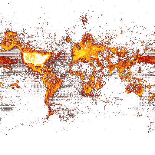
\n| *Fulmarus glacialis* (northern fulmar) observations, in Arctic projection <br/>   `https://api.gbif.org/v2/map/occurrence/density/{z}/{x}/{y}@1x.png?srs=EPSG:3575&taxonKey=2481433&basisOfRecord=HUMAN_OBSERVATION&basisOfRecord=MACHINE_OBSERVATION&style=classic.point` | <a href='https://api.gbif.org/v2/map/occurrence/density/0/0/0@1x.png?srs=EPSG:3575&taxonKey=2481433&basisOfRecord=HUMAN_OBSERVATION&basisOfRecord=MACHINE_OBSERVATION&style=classic.point'><img src='https://api.gbif.org/v2/map/occurrence/density/0/0/0@1x.png?srs=EPSG:3575&taxonKey=2481433&basisOfRecord=HUMAN_OBSERVATION&basisOfRecord=MACHINE_OBSERVATION&style=classic.point' width='64' height='64' style='max-width: inherit;'/></a> | <a href='https://api.gbif.org/v2/map/demo7.html'><img src='https://api.gbif.org/v2/map/occurrence/density/0/0/0@1x.png?srs=EPSG:3575&taxonKey=2481433&basisOfRecord=HUMAN_OBSERVATION&basisOfRecord=MACHINE_OBSERVATION&style=classic.point' width='64' height='64' style='max-width: inherit; background-image: url(https://tile.gbif.org/3575/omt/0/0/0@1x.png?style=gbif-classic); background-size: 64px 64px;'/></a>\n| Ad-hoc query for fungi with images, and without detected geospatial issues <br/>   `https://api.gbif.org/v2/map/occurrence/adhoc/{z}/{x}/{y}@1x.png?srs=EPSG:4326&mode=GEO_CENTROID&taxonKey=6&hasGeospatialIssue=false&mediaType=StillImage&style=scaled.circles` | <a href='https://api.gbif.org/v2/map/occurrence/adhoc/0/0/0@1x.png?srs=EPSG:4326&mode=GEO_CENTROID&taxonKey=6&hasGeospatialIssue=false&mediaType=StillImage&style=scaled.circles'><img src='https://api.gbif.org/v2/map/occurrence/adhoc/0/0/0@1x.png?srs=EPSG:4326&mode=GEO_CENTROID&taxonKey=6&hasGeospatialIssue=false&mediaType=StillImage&style=scaled.circles' width='64' height='64' style='max-width: inherit;'/></a> | <a href='https://api.gbif.org/v2/map/demo13.html'><img src='https://api.gbif.org/v2/map/occurrence/adhoc/0/1/0@1x.png?srs=EPSG:4326&mode=GEO_CENTROID&taxonKey=6&hasGeospatialIssue=false&mediaType=StillImage&style=scaled.circles' width='64' height='64' style='max-width: inherit; background-image: url(https://tile.gbif.org/4326/omt/0/1/0@1x.png?style=gbif-geyser); background-size: 64px 64px;'/></a>
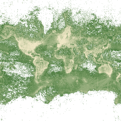
\n\nSee also [further examples and demos](https://api.gbif.org/v2/map/demo.html), and an example using [CodePen](https://codepen.io/hofft/pen/GRROjmo)\n\n## Projections\n\nThe projection defines how coordinates on Earth are transformed to a two-dimensional surface.\n\nThe tile schema defines how that two dimensional surface is split into smaller square images, and how those images are addressed.\n\nUp to four projections are available, depending on the endpoint.  Information on the projections is available on the [GBIF base map tiles](https://tile.gbif.org/ui/) page.\n\n## Map styling\n\nVector tiles must by styled by the client.\n\nRaster styles are predefined, and chosen with the `style=` parameter.  All available styles are shown below. Note the styles labelled \u201capproimate\u201d are not intended for precise analysis.\n\n<table style='text-align: center; border-collapse: collapse;'>\n  <tr>\n    <th colspan='2'>Style</th>\n    <th colspan='10'>Record count</th>\n  </tr>\n  <tr>\n    <th></th>\n    <th></th>\n    <td colspan='2' width='14%'>1\u201310</td>\n    <td colspan='2' width='14%'>11\u2013100</td>\n    <td colspan='2' width='14%'>101\u20131000</td>\n    <td colspan='2' width='14%'>1001\u201310000</td>\n    <td width='14%'>10001\u2013100000</td>\n    <td width='14%'>100001+</td>\n  </tr>\n\n  <tr>\n    <th rowspan='3'>Classic</th>\n    <td><img src='https://api.gbif.org/v2/map/occurrence/density/0/0/0@Hx.png?style=classic.point&amp;srs=EPSG:4326&amp;taxonKey=797' title='classic.point' width='128'><br>classic.point</td>\n    <td colspan='2' rowspan='3' style='background-color:#FFFF00'></td>\n    <td colspan='2' rowspan='3' style='background-color:#FFCC00'></td>\n    <td colspan='2' rowspan='3' style='background-color:#FF9900'></td>\n    <td colspan='2' rowspan='3' style='background-color:#FF6600'></td>\n    <td colspan='1' rowspan='3' style='background-color:#D60A00'></td>\n    <td colspan='1' rowspan='3' style='background-color:#C2002D'></td>\n  </tr>\n  <tr>\n    <td><img src='https://api.gbif.org/v2/map/occurrence/density/0/0/0@Hx.png?bin=hex&amp;hexPerTile=20&amp;style=classic.poly&amp;srs=EPSG:4326&amp;taxonKey=797' title='classic.point' width='128'><br>classic.poly</td>\n  </tr>\n  <tr>\n    <td><img src='https://api.gbif.org/v2/map/occurrence/density/0/0/0@Hx.png?bin=hex&amp;hexPerTile=20&amp;style=classic-noborder.poly&amp;srs=EPSG:4326&amp;taxonKey=797' title='classic-noborder.point' width='128'><br>classic-noborder.poly</td>\n  </tr>\n\n  <tr>\n    <th rowspan='3'>Purple-yellow</th>\n    <td><img src='https://api.gbif.org/v2/map/occurrence/density/0/0/0@Hx.png?style=purpleYellow.point&amp;srs=EPSG:4326&amp;taxonKey=797' title='purpleYellow.point' width='128'><br>purpleYellow.point</td>\n    <td rowspan='3' style='background-color:#5e0063'></td>\n    <td rowspan='3' style='background-color:#851362'></td>\n    <td rowspan='3' style='background-color:#a42e61'></td>\n    <td rowspan='3' style='background-color:#be4c60'></td>\n    <td rowspan='3' style='background-color:#d26b63'></td>\n    <td rowspan='3' style='background-color:#e28b6b'></td>\n    <td rowspan='3' style='background-color:#eeab79'></td>\n    <td rowspan='3' style='background-color:#f7cb8e'></td>\n    <td colspan='2' rowspan='3' style='background-color:#ffebaa'></td>\n  </tr>\n  <tr>\n    <td><img src='https://api.gbif.org/v2/map/occurrence/density/0/0/0@Hx.png?bin=hex&amp;hexPerTile=20&amp;style=purpleYellow.poly&amp;srs=EPSG:4326&amp;taxonKey=797' title='purpleYellow.point' width='128'><br>purpleYellow.poly</td>\n  </tr>\n  <tr>\n    <td><img src='https://api.gbif.org/v2/map/occurrence/density/0/0/0@Hx.png?bin=hex&amp;hexPerTile=20&amp;style=purpleYellow-noborder.poly&amp;srs=EPSG:4326&amp;taxonKey=797' title='purpleYellow-noborder.point' width='128'><br>purpleYellow-noborder.poly</td>\n  </tr>\n\n  <tr>\n    <th rowspan='3'>Green</th>\n    <td><img src='https://api.gbif.org/v2/map/occurrence/density/0/0/0@Hx.png?style=green.point&amp;srs=EPSG:4326&amp;taxonKey=797' title='green.point' width='128'><br>green.point</td>\n    <td rowspan='3' style='background-color:#4D7C40'></td>\n    <td rowspan='3' style='background-color:#608A50'></td>\n    <td rowspan='3' style='background-color:#70955E'></td>\n    <td rowspan='3' style='background-color:#85A36F'></td>\n    <td rowspan='3' style='background-color:#95AD7C'></td>\n    <td rowspan='3' style='background-color:#AABA8D'></td>\n    <td rowspan='3' style='background-color:#BAC599'></td>\n    <td rowspan='3' style='background-color:#CCD0A8'></td>\n    <td rowspan='3' style='background-color:#DFDCB7'></td>\n    <td rowspan='3' style='background-color:#EFE6C4'></td>\n  </tr>\n  <tr>\n    <td><img src='https://api.gbif.org/v2/map/occurrence/density/0/0/0@Hx.png?bin=hex&amp;hexPerTile=20&amp;style=green.poly&amp;srs=EPSG:4326&amp;taxonKey=797' title='green.point' width='128'><br>green.poly</td>\n  </tr>\n  <tr>\n    <td><img src='https://api.gbif.org/v2/map/occurrence/density/0/0/0@Hx.png?bin=hex&amp;hexPerTile=20&amp;style=green-noborder.poly&amp;srs=EPSG:4326&amp;taxonKey=797' title='green.point' width='128'><br>green-noborder.poly</td>\n  </tr>\n\n  <tr>\n    <th rowspan='4'>Heat</th>\n    <td><img src='https://api.gbif.org/v2/map/occurrence/density/0/0/0@Hx.png?style=purpleHeat.point&amp;srs=EPSG:4326&amp;taxonKey=797' title='purpleHeat.point' width='128'><br>purpleHeat.point</td>\n    <td colspan='10' style='background: linear-gradient(to right, #ff21ad, #ffacff);'>Approximate</td>\n  </tr>\n  <tr>\n    <td><img src='https://api.gbif.org/v2/map/occurrence/density/0/0/0@Hx.png?style=blueHeat.point&amp;srs=EPSG:4326&amp;taxonKey=797' title='blueHeat.point' width='128'><br>blueHeat.point</td>\n    <td colspan='10' style='background: linear-gradient(to right, #206EFF, #a9fcff);'>Approximate</td>\n  </tr>\n  <tr>\n    <td><img src='https://api.gbif.org/v2/map/occurrence/density/0/0/0@Hx.png?style=orangeHeat.point&amp;srs=EPSG:4326&amp;taxonKey=797' title='orangeHeat.point' width='128'><br>orangeHeat.point</td>\n    <td colspan='10' style='background: linear-gradient(to right, #C06719, #fffb90);'>Approximate</td>\n  </tr>\n  <tr>\n    <td><img src='https://api.gbif.org/v2/map/occurrence/density/0/0/0@Hx.png?style=greenHeat.point&amp;srs=EPSG:4326&amp;taxonKey=797' title='greenHeat.point' width='128'><br>greenHeat.point</td>\n    <td colspan='10' style='background: linear-gradient(to right, #369617, #daff88);'>Approximate</td>\n  </tr>\n\n  <tr>\n    <th>Fire</th>\n    <td><img src='https://api.gbif.org/v2/map/occurrence/density/0/0/0@Hx.png?style=fire.point&amp;srs=EPSG:4326&amp;taxonKey=797' title='fire.point' width='128'><br>fire.point</td>\n    <td colspan='10' style='background: linear-gradient(to right, #5E0700, #EF4712, #DC6902, #F09C00, #F2F7F0)'>Approximate</td>\n  </tr>\n\n  <tr>\n    <th>Glacier</th>\n    <td><img src='https://api.gbif.org/v2/map/occurrence/density/0/0/0@Hx.png?style=glacier.point&amp;srs=EPSG:4326&amp;taxonKey=797' title='glacier.point' width='128'><br>glacier.point</td>\n    <td colspan='10' style='background: linear-gradient(to right, #045a8d, #2b8cbe, #74a9cf, #bdc9e1, #f1eef6)'>Approximate</td>\n  </tr>\n\n  <tr>\n    <th rowspan='2'>Green 2</th>\n    <td><img src='https://api.gbif.org/v2/map/occurrence/density/0/0/0@Hx.png?bin=hex&amp;hexPerTile=20&amp;style=green2.poly&amp;srs=EPSG:4326&amp;taxonKey=797' title='green2.point' width='128'><br>green2.poly</td>\n    <td colspan='2' rowspan='2' style='background-color:#edf8e9'></td>\n    <td colspan='2' rowspan='2' style='background-color:#bae4b3'></td>\n    <td colspan='2' rowspan='2' style='background-color:#74c476'></td>\n    <td colspan='2' rowspan='2' style='background-color:#31a354'></td>\n    <td colspan='2' rowspan='2' style='background-color:#006d2c'></td>\n  </tr>\n  <tr>\n    <td><img src='https://api.gbif.org/v2/map/occurrence/density/0/0/0@Hx.png?bin=hex&amp;hexPerTile=20&amp;style=green2-noborder.poly&amp;srs=EPSG:4326&amp;taxonKey=797' title='green2.point' width='128'><br>green2-noborder.poly</td>\n  </tr>\n\n  <tr>\n    <th>iNaturalist</th>\n    <td><img src='https://api.gbif.org/v2/map/occurrence/density/0/0/0@Hx.png?bin=hex&amp;hexPerTile=20&amp;style=iNaturalist.poly&amp;srs=EPSG:4326&amp;taxonKey=797' title='iNaturalist.point' width='128'><br>iNaturalist.poly</td>\n    <td colspan='2' style='background-color:#F7005A; opacity 0.9'></td>\n    <td colspan='2' style='background-color:#D50067; opacity 0.9'></td>\n    <td colspan='2' style='background-color:#B5006C; opacity 0.9'></td>\n    <td colspan='2' style='background-color:#94006A; opacity 0.9'></td>\n    <td style='background-color:#72005F; opacity 0.9'></td>\n    <td style='background-color:#52034E; opacity 0.9'></td>\n  </tr>\n\n  <tr>\n    <th>Purple-white</th>\n    <td><img src='https://api.gbif.org/v2/map/occurrence/density/0/0/0@Hx.png?bin=hex&amp;hexPerTile=20&amp;style=purpleWhite.poly&amp;srs=EPSG:4326&amp;taxonKey=797' title='purpleWhite.point' width='128'><br>purpleWhite.poly</td>\n    <td style='background-color:#a000a0'></td>\n    <td style='background-color:#ab1fab'></td>\n    <td style='background-color:#b73fb7'></td>\n    <td style='background-color:#c35fc3'></td>\n    <td style='background-color:#cf7fcf'></td>\n    <td style='background-color:#db9fdb'></td>\n    <td style='background-color:#e7bfe7'></td>\n    <td style='background-color:#f3dff3'></td>\n    <td colspan='2' style='background-color:#ffffff'></td>\n  </tr>\n\n  <tr>\n    <th>Red</th>\n    <td><img src='https://api.gbif.org/v2/map/occurrence/density/0/0/0@Hx.png?bin=hex&amp;hexPerTile=20&amp;style=red.poly&amp;srs=EPSG:4326&amp;taxonKey=797' title='red.point' width='128'><br>red.poly</td>\n    <td colspan='10' style='background-color:#cc0000'></td>\n  </tr>\n\n  <tr>\n    <th rowspan='3'>Marker</th>\n    <td><img src='https://api.gbif.org/v2/map/occurrence/density/0/0/0@Hx.png?bin=hex&amp;hexPerTile=20&amp;style=blue.marker&amp;srs=EPSG:4326&amp;taxonKey=797' title='blue.marker' width='128'><br>blue.marker</td>\n    <td colspan='2' style='background: radial-gradient(circle, #209fffa7  4px, white  4px);'></td>\n    <td colspan='2' style='background: radial-gradient(circle, #209fffa7  8px, white  8px);'></td>\n    <td colspan='2' style='background: radial-gradient(circle, #209fffa7 12px, white 12px);'></td>\n    <td colspan='2' style='background: radial-gradient(circle, #209fffa7 14px, white 14px);'></td>\n    <td style='background: radial-gradient(circle, #209fffa7 16px, white 16px);'></td>\n    <td style='background: radial-gradient(circle, #209fffa7 25px, white 25px);'></td>\n  </tr>\n  <tr>\n    <td><img src='https://api.gbif.org/v2/map/occurrence/density/0/0/0@Hx.png?bin=hex&amp;hexPerTile=20&amp;style=orange.marker&amp;srs=EPSG:4326&amp;taxonKey=797' title='orange.marker' width='128'><br>orange.marker</td>\n    <td colspan='2' style='background: radial-gradient(circle, #FF6347CD  4px, white  4px);'></td>\n    <td colspan='2' style='background: radial-gradient(circle, #FF6347CD  8px, white  8px);'></td>\n    <td colspan='2' style='background: radial-gradient(circle, #FF6347CD 12px, white 12px);'></td>\n    <td colspan='2' style='background: radial-gradient(circle, #FF6347CD 14px, white 14px);'></td>\n    <td style='background: radial-gradient(circle, #FF6347CD 16px, white 16px);'></td>\n    <td style='background: radial-gradient(circle, #FF6347CD 25px, white 25px);'></td>\n  </tr>\n  <tr>\n    <td><img src='https://api.gbif.org/v2/map/occurrence/density/0/0/0@Hx.png?bin=hex&amp;hexPerTile=20&amp;style=outline.poly&amp;srs=EPSG:4326&amp;taxonKey=797' title='outline.poly' width='128'><br>outline.poly</td>\n    <td colspan='10' style='background: radial-gradient(circle, white 15px, #7b7b7bcd 16px, white 17px);'></td>\n  </tr>\n\n  <tr>\n    <th rowspan='3'>Geo-centroid</th>\n    <td><img src='https://api.gbif.org/v2/map/occurrence/adhoc/0/0/0@Hx.png?mode=GEO_CENTROID&amp;style=scaled.circles&amp;srs=EPSG:4326&amp;taxonKey=797' title='scaled.circles' width='128'><br>scaled.circles</td>\n    <td colspan='2' style='background: radial-gradient(circle, #fed976ff  6px, white  6px);'></td>\n    <td colspan='2' style='background: radial-gradient(circle, #fd8d3ccd  7px, white  7px);'></td>\n    <td colspan='2' style='background: radial-gradient(circle, #fd8d3cb3 10px, white 10px);'></td>\n    <td colspan='2' style='background: radial-gradient(circle, #f03b2099 16px, white 16px);'></td>\n    <td colspan='3' style='background: radial-gradient(circle, #bd002699 30px, white 30px);'></td>\n  </tr>\n</table>\n\n## Base map tiles\n\nBase map tiles showing land and oceans, forests, roads and so on are available at [tile.gbif.org](https://tile.gbif.org/) for users of this API.\n\n## Further resources\n\n* [Base map examples](https://tile.gbif.org/ui/)\n* [Raster style demos](https://api.gbif.org/v2/map/demo.html)\n* [OpenLayers-based toolbox](https://api.gbif.org/v2/map/debug/ol/)\n","termsOfService":"https://www.gbif.org/terms","version":"v2"},"servers":[{"url":"https://api.gbif.org/v2/","description":"Production"},{"url":"https://api.gbif-uat.org/v2/","description":"User testing"}],"tags":[{"name":"Occurrence maps","description":"This API provides pre-calculated and ad-hoc occurrence map tiles.","x-Order":{"Order":"0100"}}],"paths":{"/map/occurrence/density/{z}/{x}/{y}{format}":{"get":{"tags":["Occurrence maps"],"summary":"Precalculated density tile","description":"Retrieves a tile showing occurrence locations in [Mapbox Vector Tile format](https://www.mapbox.com/vector-tiles/)\n\nTiles contain a single layer `occurrence`. Features in that layer are either points (default) or polygons (if chosen). Each feature has a `total` value; that is the number of occurrences at that point or in the polygon.\n\n**One primary search parameter is permitted**, from these: `taxonKey`, `datasetKey`, `country`, `networkKey`, `publishingOrg`, `publishingCountry`.\n\nThis can be combined with the parameter `country`, this limits the primary search to occurrences in that country.\n\n","operationId":"getDensityTile","parameters":[{"name":"z","in":"path","description":"Zoom level","required":true,"schema":{"type":"string","maximum":16,"minimum":0}},{"name":"x","in":"path","description":"Tile map column. 0 is the leftmost column, at the rightmost column `x == 2\u1dbb \u2013 1`, except for EPSG:4326 projection where `x == 2\u1dbb\u207a\u00b9 \u2013 1`","required":true,"schema":{"type":"string","minimum":0}},{"name":"y","in":"path","description":"Tile map row. 0 is the top row, for the bottom row `y == 2\u1dbb \u2013 1`.","required":true,"schema":{"type":"string","minimum":0}},{"name":"srs","in":"query","description":"Map projection. One of\n* `EPSG:3857` (Web Mercator)\n* `EPSG:4326` (WGS84 plate care\u00e9)\n* `EPSG:3575` (Arctic LAEA)\n* `EPSG:3031` (Antarctic stereographic)\nSee [Projections](#projections)","required":true,"schema":{"type":"string","enum":["EPSG:3857","EPSG:4326","EPSG:3575","EPSG:3031"]}},{"name":"basisOfRecord","in":"query","description":"Basis of record, as defined in our BasisOfRecord vocabulary.\n\nThe parameter may be repeated to retrieve occurrences with any of the chosen bases of record.","required":false,"explode":true,"schema":{"type":"array","items":{"type":"string","description":"The values of the Darwin Core term Basis of Record which can apply to occurrences.\n\nSee GBIF's [Darwin Core Type Vocabulary](https://rs.gbif.org/vocabulary/dwc/basis_of_record.xml) for definitions.","enum":["PRESERVED_SPECIMEN","FOSSIL_SPECIMEN","LIVING_SPECIMEN","OBSERVATION","HUMAN_OBSERVATION","MACHINE_OBSERVATION","MATERIAL_SAMPLE","LITERATURE","MATERIAL_CITATION","OCCURRENCE","UNKNOWN"],"externalDocs":{"description":"API call to retrieve all official values.","url":"https://api.gbif.org/v1/enumeration/basic/BasisOfRecord"},"uniqueItems":true},"uniqueItems":true}},{"name":"year","in":"query","description":"The 4 digit year or year range. A year of 98 will be interpreted as 98 AD.\n\nRanges are written as `1990,2000`, `1990,` or `,1900`.","required":false,"schema":{"type":"string"}},{"name":"verbose","in":"query","description":"If set, counts will be grouped by year to allow a fast view of different years. If unset (the default), the total will be a count for all years.","required":false,"schema":{"type":"boolean"}},{"name":"bin","in":"query","description":"Binning style.  `hex` will aggregate points into a hexagonal grid (see `hexPerTile`). `square` will aggregate into a square grid (see `squareSize`).","required":false,"schema":{"type":"string","enum":["hex","square"]}},{"name":"hexPerTile","in":"query","description":"With `bin=hex`, sets the number of hexagons horizontally across a tile.","required":false,"schema":{"type":"integer","format":"int32","default":51}},{"name":"squareSize","in":"query","description":"With `bin=square`, sets the size of the squares in pixels on a 4096px tile.  Choose a factor of 4096 so they tessalete correctly.","required":false,"schema":{"type":"string","enum":["1","2","4","8","16","32","64","128","256","512","1024","2048","4096"]}},{"name":"style","in":"query","description":"Raster map style \u2014 only applies to raster (PNG) tiles.\n\nChoose from one of the available styles, the default is `classic.point`.\n\nStyles ending with `.point` should only be used by non-binned tiles.  Styles ending with `.poly` or `.marker.` should be used with hexagonal- or square-binned tiles.\n\nSee [map styles](#section/Map-styling).","schema":{"type":"string","enum":["purpleHeat.point","blueHeat.point","orangeHeat.point","greenHeat.point","classic.point","purpleYellow.point","green.point","fire.point","glacier.point","classic.poly","classic-noborder.poly","purpleYellow.poly","purpleYellow-noborder.poly","green.poly","green-noborder.poly","green2.poly","iNaturalist.poly","purpleWhite.poly","red.poly","blue.marker","orange.marker","outline.poly","scaled.circles"]}},{"name":"country","in":"query","description":"The 2-letter country code (as per ISO-3166-1) of the country in which the occurrence was recorded.","schema":{"type":"string","enum":["AF","AX","AL","DZ","AS","AD","AO","AI","AQ","AG","AR","AM","AW","AU","AT","AZ","BS","BH","BD","BB","BY","BE","BZ","BJ","BM","BT","BO","BQ","BA","BW","BV","BR","IO","BN","BG","BF","BI","KH","CM","CA","CV","KY","CF","TD","CL","CN","CX","CC","CO","KM","CD","CG","CK","CR","CI","HR","CU","CW","CY","CZ","DK","DJ","DM","DO","EC","EG","SV","GQ","ER","EE","ET","FK","FO","FJ","FI","FR","GF","PF","TF","GA","GM","GE","DE","GH","GI","GR","GL","GD","GP","GU","GT","GG","GN","GW","GY","HT","HM","VA","HN","HK","HU","IS","IN","ID","IR","IQ","IE","IM","IL","IT","JM","JP","JE","JO","KZ","KE","KI","KP","KR","KW","KG","LA","LV","LB","LS","LR","LY","LI","LT","LU","MO","MK","MG","MW","MY","MV","ML","MT","MH","MQ","MR","MU","YT","MX","FM","MD","MC","MN","ME","MS","MA","MZ","MM","NA","NR","NP","NL","NC","NZ","NI","NE","NG","NU","NF","MP","NO","OM","PK","PW","PS","PA","PG","PY","PE","PH","PN","PL","PT","PR","QA","RE","RO","RU","RW","BL","SH","KN","LC","MF","PM","VC","WS","SM","ST","SA","SN","RS","SC","SL","SG","SX","SK","SI","SB","SO","ZA","GS","SS","ES","LK","SD","SR","SJ","SZ","SE","CH","SY","TW","TJ","TZ","TH","TL","TG","TK","TO","TT","TN","TR","TM","TC","TV","UG","UA","AE","GB","US","UM","UY","UZ","VU","VE","VN","VG","VI","WF","EH","YE","ZM","ZW","AA","XK","XZ","ZZ"],"externalDocs":{"description":"API call to retrieve all official values.","url":"https://api.gbif.org/v1/enumeration/country"}}},{"name":"taxonKey","in":"query","description":"A taxon key from the GBIF backbone.","schema":{"type":"integer","format":"int32","minimum":0}},{"name":"datasetKey","in":"query","description":"The occurrence dataset key (a UUID).","schema":{"type":"string","format":"uuid"}},{"name":"publishingOrg","in":"query","description":"The publishing organization's GBIF key (a UUID).","schema":{"type":"string","format":"uuid"}},{"name":"publishingCountry","in":"query","description":"The 2-letter country code (as per ISO-3166-1) of the owning organization's country.","schema":{"type":"string","enum":["AF","AX","AL","DZ","AS","AD","AO","AI","AQ","AG","AR","AM","AW","AU","AT","AZ","BS","BH","BD","BB","BY","BE","BZ","BJ","BM","BT","BO","BQ","BA","BW","BV","BR","IO","BN","BG","BF","BI","KH","CM","CA","CV","KY","CF","TD","CL","CN","CX","CC","CO","KM","CD","CG","CK","CR","CI","HR","CU","CW","CY","CZ","DK","DJ","DM","DO","EC","EG","SV","GQ","ER","EE","ET","FK","FO","FJ","FI","FR","GF","PF","TF","GA","GM","GE","DE","GH","GI","GR","GL","GD","GP","GU","GT","GG","GN","GW","GY","HT","HM","VA","HN","HK","HU","IS","IN","ID","IR","IQ","IE","IM","IL","IT","JM","JP","JE","JO","KZ","KE","KI","KP","KR","KW","KG","LA","LV","LB","LS","LR","LY","LI","LT","LU","MO","MK","MG","MW","MY","MV","ML","MT","MH","MQ","MR","MU","YT","MX","FM","MD","MC","MN","ME","MS","MA","MZ","MM","NA","NR","NP","NL","NC","NZ","NI","NE","NG","NU","NF","MP","NO","OM","PK","PW","PS","PA","PG","PY","PE","PH","PN","PL","PT","PR","QA","RE","RO","RU","RW","BL","SH","KN","LC","MF","PM","VC","WS","SM","ST","SA","SN","RS","SC","SL","SG","SX","SK","SI","SB","SO","ZA","GS","SS","ES","LK","SD","SR","SJ","SZ","SE","CH","SY","TW","TJ","TZ","TH","TL","TG","TK","TO","TT","TN","TR","TM","TC","TV","UG","UA","AE","GB","US","UM","UY","UZ","VU","VE","VN","VG","VI","WF","EH","YE","ZM","ZW","AA","XK","XZ","ZZ"],"externalDocs":{"description":"API call to retrieve all official values.","url":"https://api.gbif.org/v1/enumeration/country"}}},{"name":"networkKey","in":"query","description":"The network's GBIF key (a UUID).","schema":{"type":"string","format":"uuid"}}],"responses":{"200":{"description":"Map tile.","content":{"application/x-protobuf":{"example":null},"image/png":{"example":null}}},"204":{"description":"Empty map tile."},"400":{"description":"Incorrect request."}}}},"/map/occurrence/density/capabilities.json":{"get":{"tags":["Occurrence maps"],"summary":"Summary of a density tile map query","description":"A summary of the data available for a [density tile](#operation/getDensityTile) query.\n\nIt accepts the same search parameters as the density tile query.","operationId":"getDensityCapabilities","parameters":[{"name":"basisOfRecord","in":"query","description":"Basis of record, as defined in our BasisOfRecord vocabulary.\n\nThe parameter may be repeated to retrieve occurrences with any of the chosen bases of record.","explode":true,"schema":{"type":"array","items":{"type":"string","description":"The values of the Darwin Core term Basis of Record which can apply to occurrences.\n\nSee GBIF's [Darwin Core Type Vocabulary](https://rs.gbif.org/vocabulary/dwc/basis_of_record.xml) for definitions.","enum":["PRESERVED_SPECIMEN","FOSSIL_SPECIMEN","LIVING_SPECIMEN","OBSERVATION","HUMAN_OBSERVATION","MACHINE_OBSERVATION","MATERIAL_SAMPLE","LITERATURE","MATERIAL_CITATION","OCCURRENCE","UNKNOWN"],"externalDocs":{"description":"API call to retrieve all official values.","url":"https://api.gbif.org/v1/enumeration/basic/BasisOfRecord"},"uniqueItems":true},"uniqueItems":true}},{"name":"country","in":"query","description":"The 2-letter country code (as per ISO-3166-1) of the country in which the occurrence was recorded.","schema":{"type":"string","enum":["AF","AX","AL","DZ","AS","AD","AO","AI","AQ","AG","AR","AM","AW","AU","AT","AZ","BS","BH","BD","BB","BY","BE","BZ","BJ","BM","BT","BO","BQ","BA","BW","BV","BR","IO","BN","BG","BF","BI","KH","CM","CA","CV","KY","CF","TD","CL","CN","CX","CC","CO","KM","CD","CG","CK","CR","CI","HR","CU","CW","CY","CZ","DK","DJ","DM","DO","EC","EG","SV","GQ","ER","EE","ET","FK","FO","FJ","FI","FR","GF","PF","TF","GA","GM","GE","DE","GH","GI","GR","GL","GD","GP","GU","GT","GG","GN","GW","GY","HT","HM","VA","HN","HK","HU","IS","IN","ID","IR","IQ","IE","IM","IL","IT","JM","JP","JE","JO","KZ","KE","KI","KP","KR","KW","KG","LA","LV","LB","LS","LR","LY","LI","LT","LU","MO","MK","MG","MW","MY","MV","ML","MT","MH","MQ","MR","MU","YT","MX","FM","MD","MC","MN","ME","MS","MA","MZ","MM","NA","NR","NP","NL","NC","NZ","NI","NE","NG","NU","NF","MP","NO","OM","PK","PW","PS","PA","PG","PY","PE","PH","PN","PL","PT","PR","QA","RE","RO","RU","RW","BL","SH","KN","LC","MF","PM","VC","WS","SM","ST","SA","SN","RS","SC","SL","SG","SX","SK","SI","SB","SO","ZA","GS","SS","ES","LK","SD","SR","SJ","SZ","SE","CH","SY","TW","TJ","TZ","TH","TL","TG","TK","TO","TT","TN","TR","TM","TC","TV","UG","UA","AE","GB","US","UM","UY","UZ","VU","VE","VN","VG","VI","WF","EH","YE","ZM","ZW","AA","XK","XZ","ZZ"],"externalDocs":{"description":"API call to retrieve all official values.","url":"https://api.gbif.org/v1/enumeration/country"}}},{"name":"taxonKey","in":"query","description":"A taxon key from the GBIF backbone.","schema":{"type":"integer","format":"int32","minimum":0}},{"name":"datasetKey","in":"query","description":"The occurrence dataset key (a UUID).","schema":{"type":"string","format":"uuid"}},{"name":"publishingOrg","in":"query","description":"The publishing organization's GBIF key (a UUID).","schema":{"type":"string","format":"uuid"}},{"name":"publishingCountry","in":"query","description":"The 2-letter country code (as per ISO-3166-1) of the owning organization's country.","schema":{"type":"string","enum":["AF","AX","AL","DZ","AS","AD","AO","AI","AQ","AG","AR","AM","AW","AU","AT","AZ","BS","BH","BD","BB","BY","BE","BZ","BJ","BM","BT","BO","BQ","BA","BW","BV","BR","IO","BN","BG","BF","BI","KH","CM","CA","CV","KY","CF","TD","CL","CN","CX","CC","CO","KM","CD","CG","CK","CR","CI","HR","CU","CW","CY","CZ","DK","DJ","DM","DO","EC","EG","SV","GQ","ER","EE","ET","FK","FO","FJ","FI","FR","GF","PF","TF","GA","GM","GE","DE","GH","GI","GR","GL","GD","GP","GU","GT","GG","GN","GW","GY","HT","HM","VA","HN","HK","HU","IS","IN","ID","IR","IQ","IE","IM","IL","IT","JM","JP","JE","JO","KZ","KE","KI","KP","KR","KW","KG","LA","LV","LB","LS","LR","LY","LI","LT","LU","MO","MK","MG","MW","MY","MV","ML","MT","MH","MQ","MR","MU","YT","MX","FM","MD","MC","MN","ME","MS","MA","MZ","MM","NA","NR","NP","NL","NC","NZ","NI","NE","NG","NU","NF","MP","NO","OM","PK","PW","PS","PA","PG","PY","PE","PH","PN","PL","PT","PR","QA","RE","RO","RU","RW","BL","SH","KN","LC","MF","PM","VC","WS","SM","ST","SA","SN","RS","SC","SL","SG","SX","SK","SI","SB","SO","ZA","GS","SS","ES","LK","SD","SR","SJ","SZ","SE","CH","SY","TW","TJ","TZ","TH","TL","TG","TK","TO","TT","TN","TR","TM","TC","TV","UG","UA","AE","GB","US","UM","UY","UZ","VU","VE","VN","VG","VI","WF","EH","YE","ZM","ZW","AA","XK","XZ","ZZ"],"externalDocs":{"description":"API call to retrieve all official values.","url":"https://api.gbif.org/v1/enumeration/country"}}},{"name":"networkKey","in":"query","description":"The network's GBIF key (a UUID).","schema":{"type":"string","format":"uuid"}},{"name":"year","in":"query","description":"The 4 digit year or year range. A year of 98 will be interpreted as 98 AD.\n\nRanges are written as `1990,2000`, `1990,` or `,1900`."}],"responses":{"200":{"description":"Map capabilities details.","content":{"application/json":{"schema":{"$ref":"#/components/schemas/Capabilities"}}}},"400":{"description":"Invalid search request."}}}},"/map/occurrence/adhoc/{z}/{x}/{y}{format}":{"get":{"tags":["Occurrence maps"],"summary":"Ad-hoc search tile","description":"Retrieves a tile showing occurrence locations in [Mapbox Vector Tile format](https://www.mapbox.com/vector-tiles/)\n\nTiles contain a single layer `occurrence`. Features in that layer are either points (default) or polygons (if chosen). Each feature has a `total` value; that is the number of occurrences at that point or in the polygon.\n\nAny search parameter allowed by the [occurrence search](/en/openapi/v1/occurrence#tag/Searching-occurrences/operation/searchOccurrence) is supported.","operationId":"getAdHocTile","parameters":[{"name":"z","in":"path","description":"Zoom level","required":true,"schema":{"type":"string","maximum":16,"minimum":0}},{"name":"x","in":"path","description":"Tile map column. 0 is the leftmost column, at the rightmost column `x == 2\u1dbb \u2013 1`, except for EPSG:4326 projection where `x == 2\u1dbb\u207a\u00b9 \u2013 1`","required":true,"schema":{"type":"string","minimum":0}},{"name":"y","in":"path","description":"Tile map row. 0 is the top row, for the bottom row `y == 2\u1dbb \u2013 1`.","required":true,"schema":{"type":"string","minimum":0}},{"name":"srs","in":"query","description":"Map projection. One of\n* `EPSG:3857` (Web Mercator)\n* `EPSG:4326` (WGS84 plate care\u00e9)\n* `EPSG:3575` (Arctic LAEA)\n* `EPSG:3031` (Antarctic stereographic)\nSee [Projections](#projections)","required":true,"schema":{"type":"string","enum":["EPSG:3857","EPSG:4326","EPSG:3575","EPSG:3031"]}},{"name":"bin","in":"query","description":"Binning style.  `hex` will aggregate points into a hexagonal grid (see `hexPerTile`). `square` will aggregate into a square grid (see `squareSize`).","required":false,"schema":{"type":"string","enum":["hex","square"]}},{"name":"hexPerTile","in":"query","description":"With `bin=hex`, sets the number of hexagons horizontally across a tile.","required":false,"schema":{"type":"integer","format":"int32","default":51}},{"name":"squareSize","in":"query","description":"With `bin=square`, sets the size of the squares in pixels on a 4096px tile.  Choose a factor of 4096 so they tessalete correctly.","required":false,"schema":{"type":"string","enum":["1","2","4","8","16","32","64","128","256","512","1024","2048","4096"]}},{"name":"mode","in":"query","description":"Sets the search mode.  `GEO_BOUNDS` is the default, and returns rectangles that bound all the occurrences in each bin.  `GEO_CENTROID` instead returns a point at the weighted centroid of the bin.","schema":{"type":"string","enum":["GEO_BOUNDS","GEO_CENTROID"]}},{"name":"style","in":"query","description":"Raster map style \u2014 only applies to raster (PNG) tiles.\n\nChoose from one of the available styles, the default is `classic.point`.\n\nStyles ending with `.point` should only be used by non-binned tiles.  Styles ending with `.poly` or `.marker.` should be used with hexagonal- or square-binned tiles.\n\nSee [map styles](#section/Map-styling).","schema":{"type":"string","enum":["purpleHeat.point","blueHeat.point","orangeHeat.point","greenHeat.point","classic.point","purpleYellow.point","green.point","fire.point","glacier.point","classic.poly","classic-noborder.poly","purpleYellow.poly","purpleYellow-noborder.poly","green.poly","green-noborder.poly","green2.poly","iNaturalist.poly","purpleWhite.poly","red.poly","blue.marker","orange.marker","outline.poly","scaled.circles"]}},{"name":"basisOfRecord","in":"query","description":"Basis of record, as defined in our BasisOfRecord vocabulary.\n\nThe parameter may be repeated to retrieve occurrences with any of the chosen bases of record.","explode":true,"schema":{"type":"array","items":{"type":"string","description":"The values of the Darwin Core term Basis of Record which can apply to occurrences.\n\nSee GBIF's [Darwin Core Type Vocabulary](https://rs.gbif.org/vocabulary/dwc/basis_of_record.xml) for definitions.","enum":["PRESERVED_SPECIMEN","FOSSIL_SPECIMEN","LIVING_SPECIMEN","OBSERVATION","HUMAN_OBSERVATION","MACHINE_OBSERVATION","MATERIAL_SAMPLE","LITERATURE","MATERIAL_CITATION","OCCURRENCE","UNKNOWN"],"externalDocs":{"description":"API call to retrieve all official values.","url":"https://api.gbif.org/v1/enumeration/basic/BasisOfRecord"},"uniqueItems":true},"uniqueItems":true}},{"name":"country","in":"query","description":"The 2-letter country code (as per ISO-3166-1) of the country in which the occurrence was recorded.","schema":{"type":"string","enum":["AF","AX","AL","DZ","AS","AD","AO","AI","AQ","AG","AR","AM","AW","AU","AT","AZ","BS","BH","BD","BB","BY","BE","BZ","BJ","BM","BT","BO","BQ","BA","BW","BV","BR","IO","BN","BG","BF","BI","KH","CM","CA","CV","KY","CF","TD","CL","CN","CX","CC","CO","KM","CD","CG","CK","CR","CI","HR","CU","CW","CY","CZ","DK","DJ","DM","DO","EC","EG","SV","GQ","ER","EE","ET","FK","FO","FJ","FI","FR","GF","PF","TF","GA","GM","GE","DE","GH","GI","GR","GL","GD","GP","GU","GT","GG","GN","GW","GY","HT","HM","VA","HN","HK","HU","IS","IN","ID","IR","IQ","IE","IM","IL","IT","JM","JP","JE","JO","KZ","KE","KI","KP","KR","KW","KG","LA","LV","LB","LS","LR","LY","LI","LT","LU","MO","MK","MG","MW","MY","MV","ML","MT","MH","MQ","MR","MU","YT","MX","FM","MD","MC","MN","ME","MS","MA","MZ","MM","NA","NR","NP","NL","NC","NZ","NI","NE","NG","NU","NF","MP","NO","OM","PK","PW","PS","PA","PG","PY","PE","PH","PN","PL","PT","PR","QA","RE","RO","RU","RW","BL","SH","KN","LC","MF","PM","VC","WS","SM","ST","SA","SN","RS","SC","SL","SG","SX","SK","SI","SB","SO","ZA","GS","SS","ES","LK","SD","SR","SJ","SZ","SE","CH","SY","TW","TJ","TZ","TH","TL","TG","TK","TO","TT","TN","TR","TM","TC","TV","UG","UA","AE","GB","US","UM","UY","UZ","VU","VE","VN","VG","VI","WF","EH","YE","ZM","ZW","AA","XK","XZ","ZZ"],"externalDocs":{"description":"API call to retrieve all official values.","url":"https://api.gbif.org/v1/enumeration/country"}}},{"name":"taxonKey","in":"query","description":"A taxon key from the GBIF backbone.","schema":{"type":"integer","format":"int32","minimum":0}},{"name":"datasetKey","in":"query","description":"The occurrence dataset key (a UUID).","schema":{"type":"string","format":"uuid"}},{"name":"publishingOrg","in":"query","description":"The publishing organization's GBIF key (a UUID).","schema":{"type":"string","format":"uuid"}},{"name":"publishingCountry","in":"query","description":"The 2-letter country code (as per ISO-3166-1) of the owning organization's country.","schema":{"type":"string","enum":["AF","AX","AL","DZ","AS","AD","AO","AI","AQ","AG","AR","AM","AW","AU","AT","AZ","BS","BH","BD","BB","BY","BE","BZ","BJ","BM","BT","BO","BQ","BA","BW","BV","BR","IO","BN","BG","BF","BI","KH","CM","CA","CV","KY","CF","TD","CL","CN","CX","CC","CO","KM","CD","CG","CK","CR","CI","HR","CU","CW","CY","CZ","DK","DJ","DM","DO","EC","EG","SV","GQ","ER","EE","ET","FK","FO","FJ","FI","FR","GF","PF","TF","GA","GM","GE","DE","GH","GI","GR","GL","GD","GP","GU","GT","GG","GN","GW","GY","HT","HM","VA","HN","HK","HU","IS","IN","ID","IR","IQ","IE","IM","IL","IT","JM","JP","JE","JO","KZ","KE","KI","KP","KR","KW","KG","LA","LV","LB","LS","LR","LY","LI","LT","LU","MO","MK","MG","MW","MY","MV","ML","MT","MH","MQ","MR","MU","YT","MX","FM","MD","MC","MN","ME","MS","MA","MZ","MM","NA","NR","NP","NL","NC","NZ","NI","NE","NG","NU","NF","MP","NO","OM","PK","PW","PS","PA","PG","PY","PE","PH","PN","PL","PT","PR","QA","RE","RO","RU","RW","BL","SH","KN","LC","MF","PM","VC","WS","SM","ST","SA","SN","RS","SC","SL","SG","SX","SK","SI","SB","SO","ZA","GS","SS","ES","LK","SD","SR","SJ","SZ","SE","CH","SY","TW","TJ","TZ","TH","TL","TG","TK","TO","TT","TN","TR","TM","TC","TV","UG","UA","AE","GB","US","UM","UY","UZ","VU","VE","VN","VG","VI","WF","EH","YE","ZM","ZW","AA","XK","XZ","ZZ"],"externalDocs":{"description":"API call to retrieve all official values.","url":"https://api.gbif.org/v1/enumeration/country"}}},{"name":"networkKey","in":"query","description":"The network's GBIF key (a UUID).","schema":{"type":"string","format":"uuid"}},{"name":"year","in":"query","description":"The 4 digit year or year range. A year of 98 will be interpreted as 98 AD.\n\nRanges are written as `1990,2000`, `1990,` or `,1900`."}],"responses":{"200":{"description":"Map tile.","content":{"application/x-protobuf":{"example":null},"image/png":{"example":null}}},"204":{"description":"Empty map tile."},"400":{"description":"Incorrect request."}}}}},"components":{"schemas":{"Capabilities":{"type":"object","properties":{"minLat":{"type":"integer","format":"int32","description":"The lowest latitude of occurrences covered by the query"},"maxLat":{"type":"integer","format":"int32","description":"The highest latitude of occurrences covered by the query"},"minLng":{"type":"integer","format":"int32","description":"The lowest longitude of occurrences covered by the query.\n\nFor clusters of occurrences centered around the antimeridian (180\u00b0 longitude) the `minLng` and `maxLng` will have a value just below 180\u00b0 and above 180\u00b0."},"maxLng":{"type":"integer","format":"int32","description":"The highest longitude of occurrences covered by the query.\n\nFor clusters of occurrences centered around the antimeridian (180\u00b0 longitude) the `minLng` and `maxLng` will have a value just below 180\u00b0 and above 180\u00b0."},"minYear":{"type":"integer","format":"int32","description":"The lowest year of occurrences covered by the query."},"maxYear":{"type":"integer","format":"int32","description":"The highest year of occurrences covered by the query."},"total":{"type":"integer","format":"int64","description":"The number of occurrences covered by the whole map."},"generated":{"type":"string","description":"The time the map tile was generated.  Tiles are cached for hours to days, depending on the processing required to produce them."}}}}}}